
Your cart
There are no items in your cart.

 © The Boundary
 © The Boundary
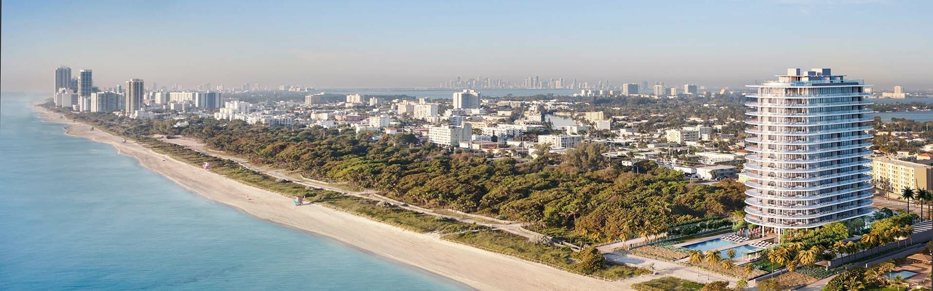
Aerial rendering involves crafting three-dimensional visual representations of architectural marvels and outdoor landscapes from elevated viewpoints, offering a unique and comprehensive outlook. In this guide, we delve into the types, benefits, and process of creating compelling aerial renderings that captivate the imagination.
An aerial 3D rendering is a pivotal tool in architecture, providing a realistic representation of project details and their impact on the surroundings. This technique plays a crucial role in various fields, including building design, urban planning, real estate and property marketing, and environmental studies.
Whether you're an architectural enthusiast, a professional in the field, or simply curious about the artistry behind aerial renderings, this guide will take you on a captivating journey into the realm where architectural visions take flight.
Aerial rendering is part of exterior architectural rendering and creates three-dimensional visual representations of architectural designs and outdoor environments from an elevated or aerial perspective. It involves producing detailed and realistic images or 3D models that showcase buildings, landscape design, infrastructure, and spatial relationships as seen from above, typically simulating the view from an aircraft, drone, or high vantage point.
We usually find three types of aerial 3D renderings in the architectural visualization field: photorealistic aerial rendering, conceptual aerial rendering, and interactive aerial rendering.
This is crucial for architectural design, marketing, and sales. Aerial renderings can be highly realistic imagery, and ray-traced renderers allow users to include realistic details, such as physically based materials, highly detailed vegetation, and accurate lighting, which enhance the overall visual quality of the representation.
Photorealistic images aim to create highly detailed and lifelike representations of architectural designs. Creating them involves meticulous attention to detail regarding textures, lighting, and materials to achieve a near-photographic quality.
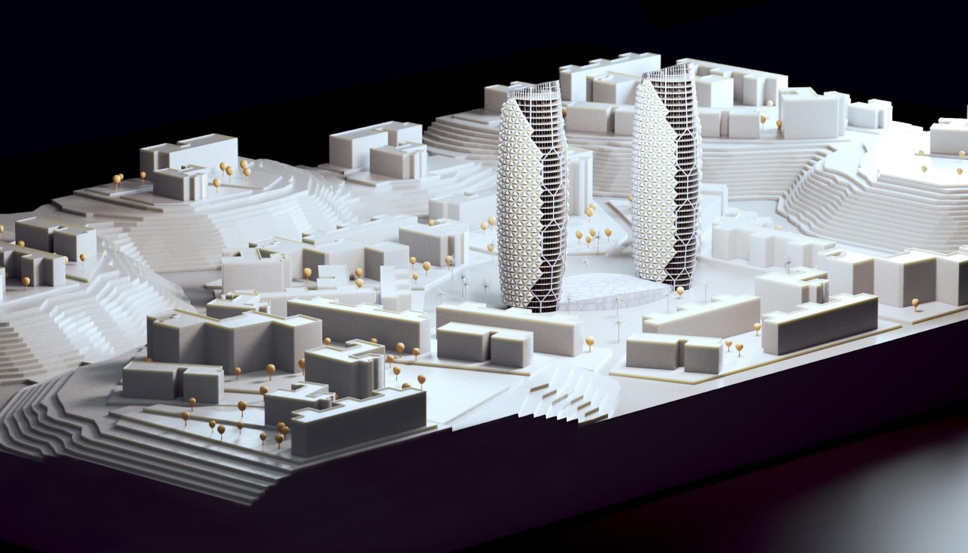
Urban planners can use conceptual 3D images to model and test different scenarios. 3D models provide depth and perspective, making it easier to understand the spatial relationships between different elements such as surrounding buildings in the environment, and help to design more efficient, sustainable, and aesthetically pleasing urban environments.
In addition, conceptual aerial renderings can incorporate various data sources, including GIS data, topographic information, and satellite imagery, enabling planners and designers to work with accurate and up-to-date data.
Interactive rendering is a dynamic form of 3D rendering that enables real-time exploration, user-controlled navigation, and immersive experiences within virtual environments. It allows viewers to interact with 3D scenes, change perspectives, and examine details closely.
This technology is used for urban planning, scenario testing, architectural design presentations, and marketing. Interactive aerial rendering provides a high level of engagement and is particularly effective for conveying spatial concepts and immersive experiences.
All 3D aerial renders are versatile tools for visualizing and assessing projects and landscapes from a unique perspective, enhancing planning, design, and decision-making processes. They offer several advantages, including:
Visual Communication: With an aerial view rendering, you can simplify complex projects by offering a comprehensive view of urban plans and landscapes, making it easier for clients and the public to grasp concepts visually.
Improved Decision-Making: An aerial 3D rendering can serve as a decision-support tool for urban planners, architects, and developers, visualizing projects, assessing environmental impact, and making informed choices.
Cost Savings: Identify potential issues early in the planning and design phases, potentially saving construction and post-development costs.
Marketing and Sales: In real estate and property development, architectural aerial renderings are potent marketing tools, showcasing properties and attracting potential buyers and investors.
Urban Planning: Urban planners use aerial rendering services to model different scenarios for designing sustainable and aesthetically pleasing urban environments.
Contextual Understanding: An aerial 3D rendering can help integrate new designs into existing landscapes, improving design compatibility.
Collaboration: Aerial 3D imagery can facilitate communication and collaboration among project stakeholders.
Project Approval: Streamline the approval process with high-quality 3d aerial visual representations.
Crafting a rendering that captures the essence of a space requires the artistry of creating an accurate and visually appealing aerial perspective. This approach not only ensures precision in representation but also strives to captivate the viewer with a compelling and immersive portrayal from above, bringing architectural visions to life in a way that is both faithful to the desired outcome and artistically engaging.
Before starting any project, it is essential to define the style of the final images, whether they are sales images or for internal design evaluation. Defining the image style determines the work route, calculating the development time and planning an appropriate methodology, as well as defining the tools and materials necessary for the project.
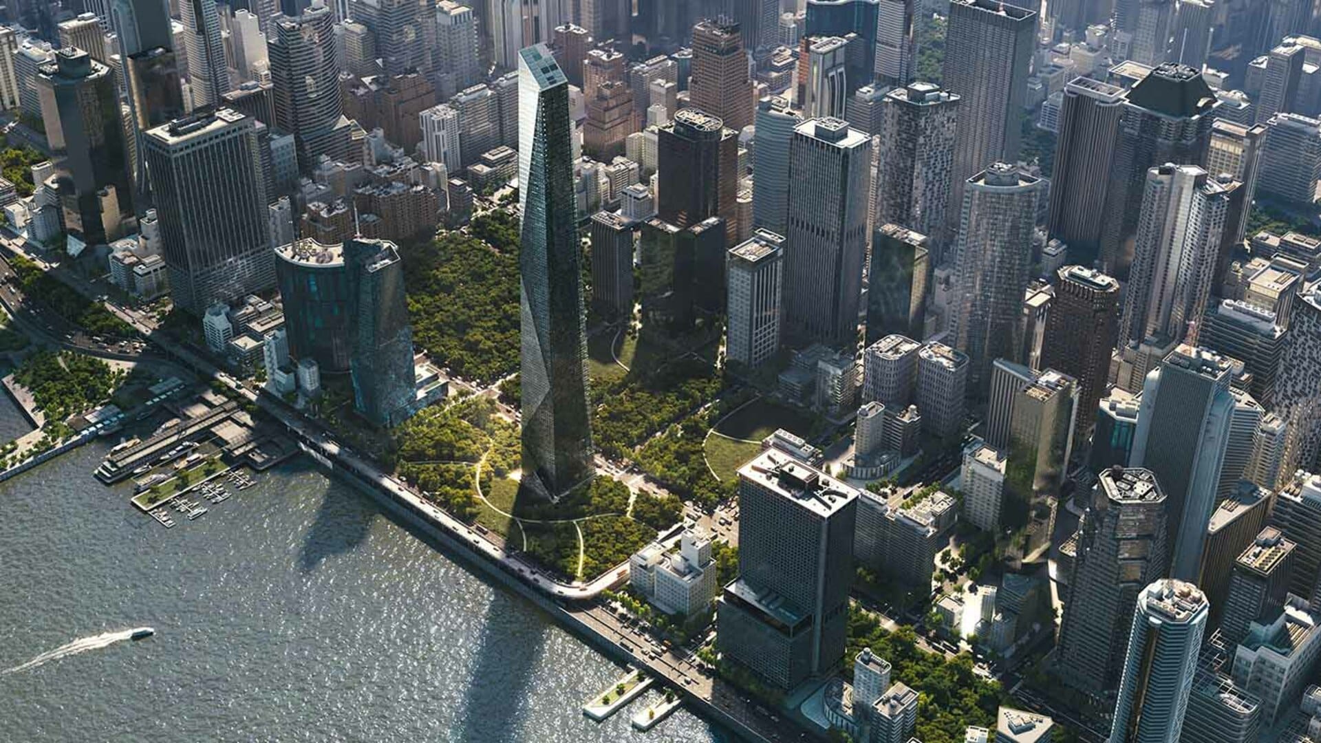
A bird's-eye-view perspective in aerial rendering refers to a viewpoint that simulates the view from directly above a scene, as if one were looking down from a high point in the sky, like a bird flying overhead. This perspective is often used in aerial renderings to create top-down visual representations of landscapes, architectural designs, or outdoor environments.

Photorealistic renders allow architects to creatively and effectively convey their design ideas. They help convey concepts, emotions, and atmospheres that may be challenging to express through technical drawings or verbal descriptions.
Visual impact is key for persuasion and sales. In real estate development projects or design presentations to new clients, photorealistic renders are persuasive tools. They can help potential investors or buyers visualize the final project and make informed decisions.
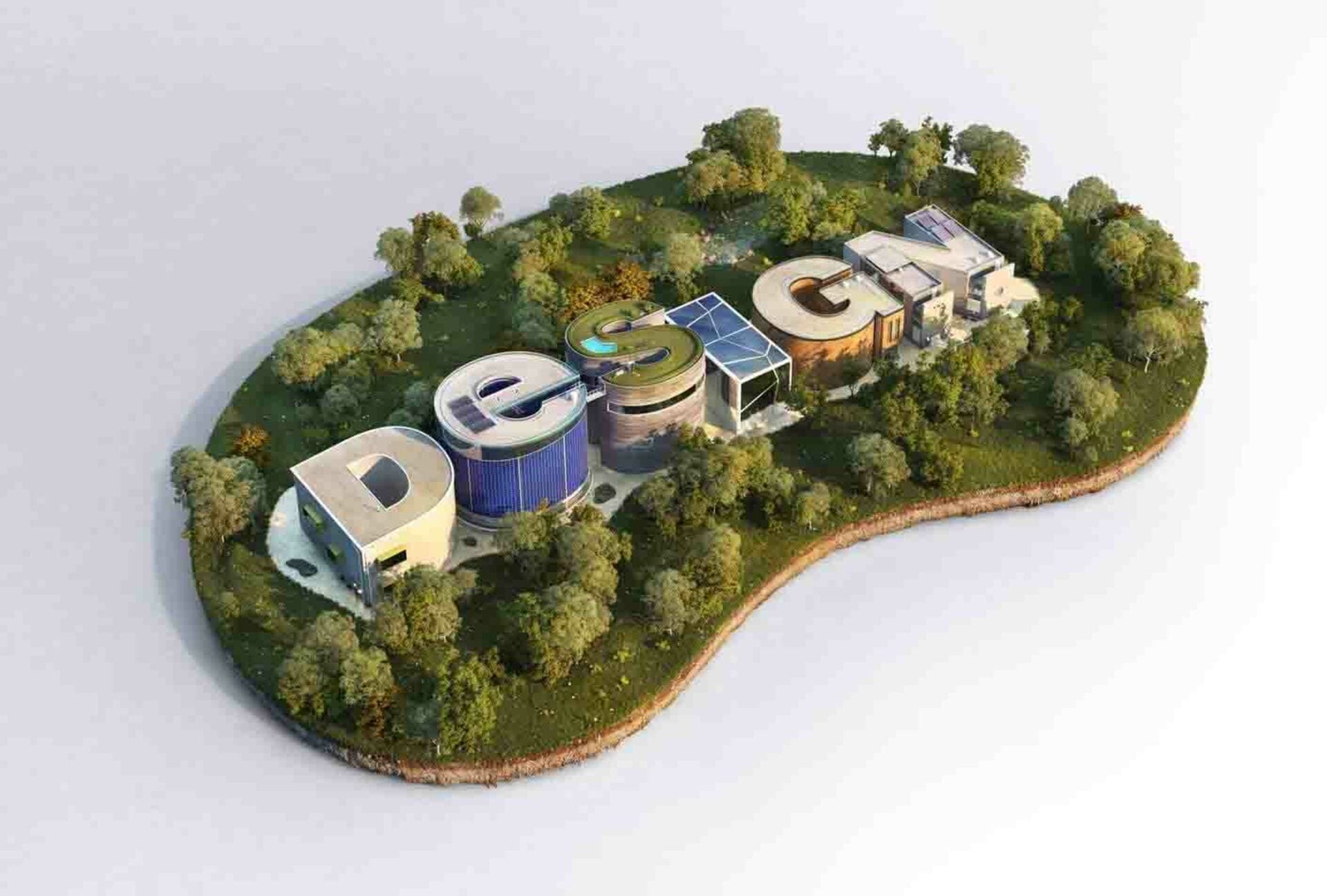
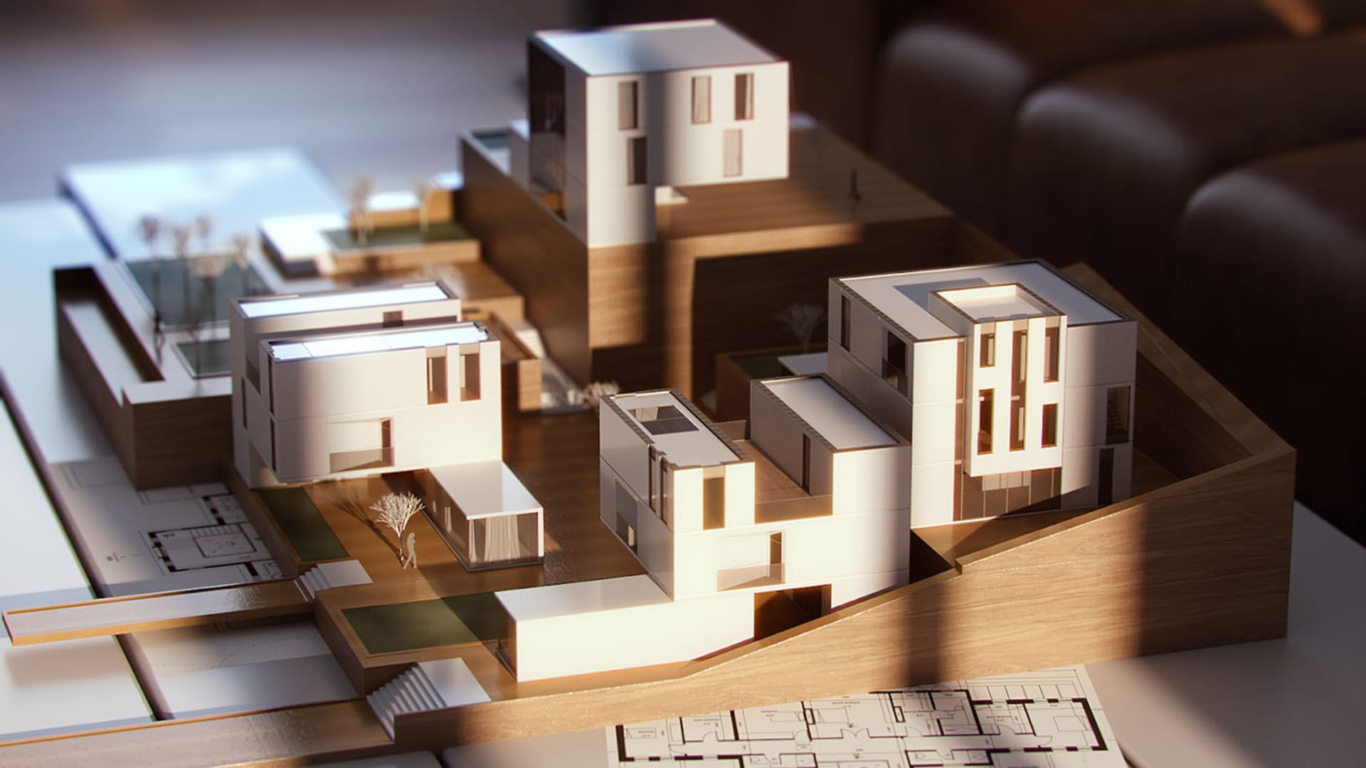
Artistic renders are a form of artistic expression in themselves. Artists can use different styles, visual effects, and techniques to create unique visual representations that capture the essence and vision of the architectural project. Architects sometimes create a maquette-style scale model as a concept for residential or commercial spaces.
Artistic renders play an essential role in architecture as an effective communication tool, a source of inspiration, a marketing tool, and a form of creative expression that contributes to the success and realization of architectural projects.
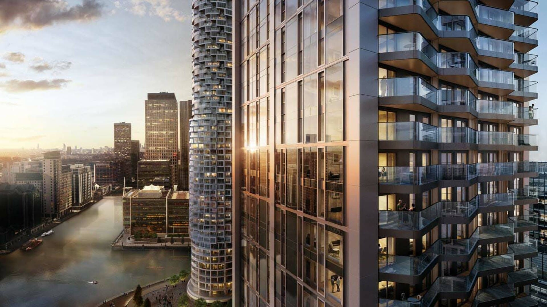
A widely employed technique to achieve architectural aerial renderings involves the composition of drone photography with CG buildings, placing them in the exact physical location of the project.
The increasingly common use of drones to capture aerial photographs, subsequently utilized as a canvas to project designs, is notable. This methodology allows for seamless design integration into its precise environment. CG artists employ tracking techniques to ensure a perfect alignment with the photograph's angle, yielding spectacular results, often challenging the distinction between what is real and what is digitally created.

To achieve stunning images, it's crucial to consider key aspects, from selecting the right angle to crafting a visual narrative, ensuring proper lighting, incorporating contextual details, and expertly using color and textures.
Composition and framing play a crucial role in rendering, contributing significantly to the visual impact and effectiveness of the final image. In aerial scene rendering, these techniques are essential to guide the viewer's eye, tell a visual story, enhance aesthetic appeal, emphasize design features, facilitate client communication, accurately portray scale, engage the viewer, and contribute to effective marketing and branding.
You can check out my article on composition and framing to find out more and get started, but these are some principle rules:
Rule of Thirds: Divide the image into a 3x3 grid and place important elements along the gridlines or intersections for balance.
Leading Lines: Use linear elements to guide the viewer's gaze toward a focal point, creating depth and visual flow.
Balance: Distribute visual elements harmoniously, either symmetrically or asymmetrically, for overall equilibrium.
Symmetry: Create a mirror image effect for formality and order in the composition.
Golden Ratio: Apply this mathematical concept to create aesthetically pleasing and balanced compositions.
Lighting and texturing are key for a successful 3D rendering because they significantly impact the final quality, realism, and visual appeal of the final renderings. Properly executed lighting and texturing can be the difference between a poor 3D render and a visually captivating and emotionally resonant one.
Lighting conditions can set the mood and atmosphere of the scene. Different lighting setups can convey various emotions, from warm and cozy to cold and eerie, influencing the viewer's perception. 3D artists usually prefer to set natural lighting for aerial renderings using image-based lighting or a physical daylight system.
Textures can also contribute to the atmosphere by adding details that suggest specific materials, such as wood, metal, or glass, and even dust and imperfections, which increase realism.
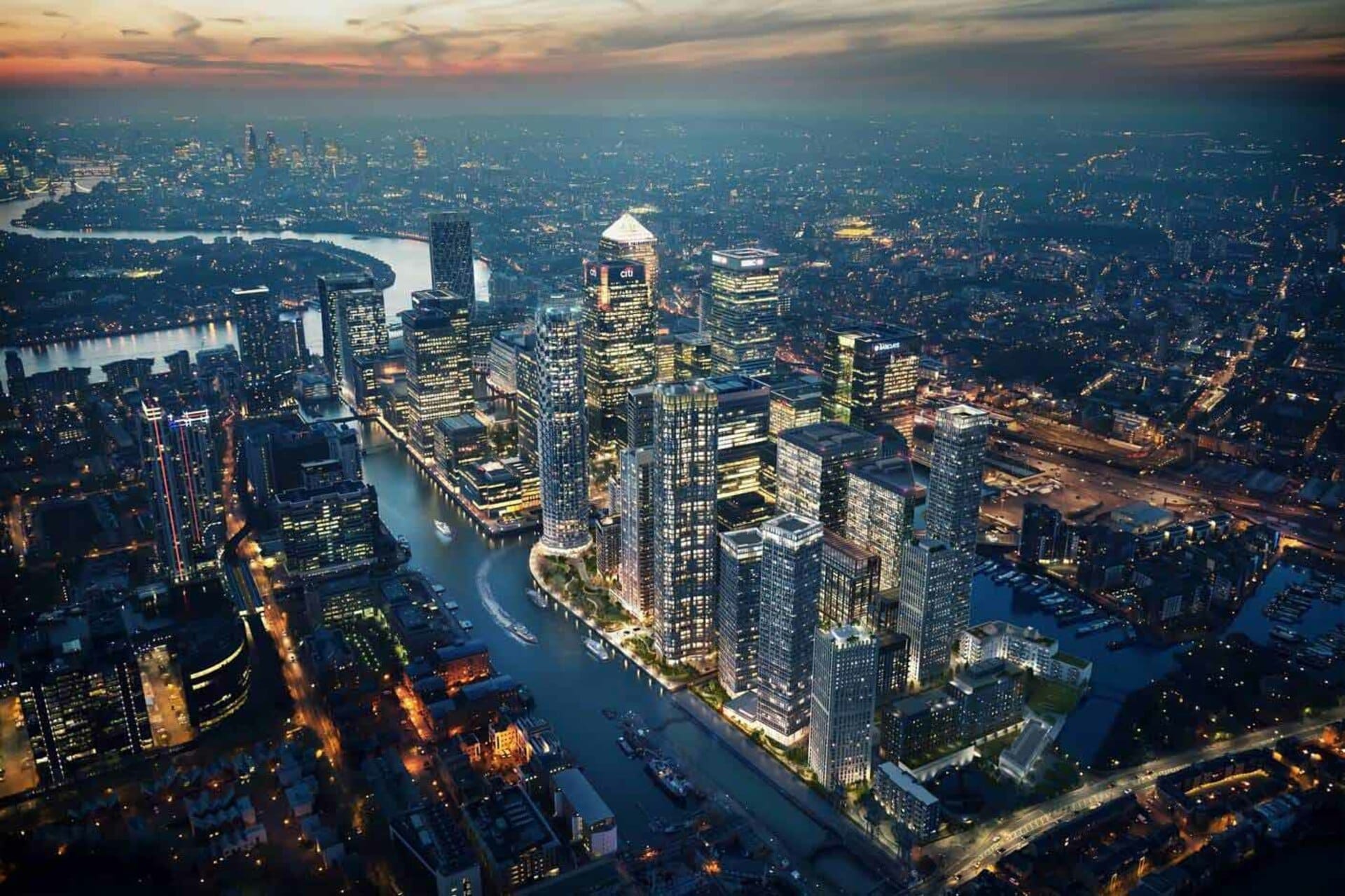
Aerial renderings gain tremendous realism and visual appeal when infused with natural elements such as trees, bodies of water, and vegetation. This integration goes beyond mere aesthetics; it contributes significantly to the overall narrative and contextual understanding of the architectural project. Here's why it's crucial:
Contextual Realism: Including natural elements places the architectural project within its real-world context, providing viewers with a sense of scale and relatability. Trees and vegetation help simulate the surrounding environment, making the rendering more believable and connected to the landscape.
Scale and Perspective: Trees and vegetation act as visual references for scale, allowing viewers to comprehend the size of structures and spaces accurately. Water bodies, such as ponds or rivers, add depth to the scene, enhancing the overall perspective and making the rendering more immersive.
Chaos Scatter is particularly useful in architectural visualization, landscape design, and scenes that require the replication of elements for added realism. It simplifies the process of creating intricate and detailed 3D environments, saving time for designers and artists.
Aerial perspective in 3D rendering involves simulating the effects the atmosphere plays on objects in the 3D scene, particularly as the surrounding landscape recedes into the distance. These techniques are invaluable for architectural visualization.
Approaches that can help include rendering objects in the background with a lighter color and less detail to mimic the real-world effect of objects appearing less distinct and bluer as they get farther away due to atmospheric scattering.
These effects add depth and realism to the scene, enhancing the perception of distance and scale. V-Ray offers this through its V-Ray Aerial Perspective and V-Ray Environment Fog features.

Post-processing for architectural rendering involves editing and enhancing imagery to achieve final results of high quality and a professional appearance. This process is carried out after the initial rendering is complete and typically involves several steps, exposure adjustment, color correction, noise reduction, texture enhancement, composition, filtering, and post-effects.
With the V-Ray Frame Buffer’s layers, you can edit renders quickly and easily without exporting the images to another application. In addition, V-Ray offers one-click powerful solutions for post-production. Just assigning a few render elements such as LightMix, Cryptomatte, and BackToBeauty will improve the quality of your renderings.
In the realm of architectural visualization, the artistry of aerial rendering serves as a transformative force, propelling designs to new heights. As we conclude this exploration into the world above, it's evident that aerial rendering is more than a visualization technique — it's a dynamic language that architects and designers speak to communicate complex ideas, immerse viewers in captivating narratives, and bring dreams to life.

Master subsurface scattering in V-Ray—understand it, use it, and optimize it for breathtakingly realistic renders.

Our latest Chaos Campus show explores what a boutique visualization and creative studio wishes every young artist knew about creativity, business, and turning passion into success.

Explore how the Chaos Corona community fosters collaboration between creatives and enriches architectural visualization with shared knowledge and expert insights.
 © Škoda Design
Get the latest news, artist spotlight stories, tips and tricks delivered to your inbox.